Upper Arlington to the Scioto River: A Short Autumn Walk
 Upper Arlington to the Scioto River: A Short Autumn Walk
A mellow half-day route from Upper Arlington's leafy streets down to the Scioto, timed for peak October colour and finished near a bridge you can walk across.
Start at Lane Avenue and work downhill
Begin where Lane Avenue meets Northwest Boulevard, the commercial spine that most Upper Arlington visitors see first. From there, head west on foot toward the river corridor on the quiet residential streets north of Lane, passing between the shops and the older tree-lined blocks around Trentwood and Canterbury. The gradient is gentle; the whole descent to the water takes roughly twenty-five minutes at an unhurried pace. October is the month to do it — the maples along the side streets turn first, usually in the second and third weeks, before the oaks catch up in early November.
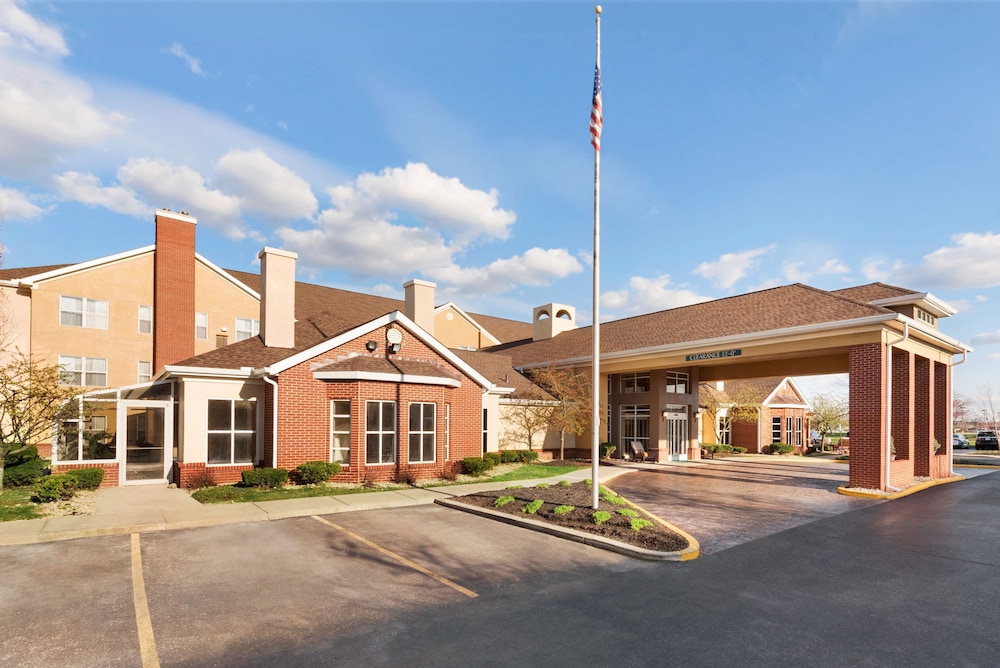
Parking is free on most residential streets but watch the posted permit zones near the high school. If you are staying in one of the hotels clustered along Lane Avenue and Olentangy River Road, you can walk the entire route without moving the car, which is the main reason I would book in that corridor rather than out toward Kenny Road or Kingsdale. Rooms in this band typically run mid-range for Columbus suburbs; rates firm up on home football weekends, so check dates before committing.
The river path at Griggs Reservoir
The walk proper begins where the residential grid meets the Griggs Reservoir parkland on the west side of the Scioto. A paved multi-use trail runs along the eastern shore, flat and wide, popular with cyclists on weekend mornings. Head north toward the dam or south toward the Lane Avenue bridge — both are easy out-and-back legs of thirty to fifty minutes. The autumn colour here is mostly sycamore and cottonwood on the bank, with the far shore showing denser hardwood stands. Bring a layer; the river channel funnels wind and the temperature drops noticeably once you leave the shelter of the streets.
This is also the most photogenic stretch in the area, especially an hour after sunrise when mist sits on the water. There are benches and a few picnic tables, but no café or kiosk, so carry water. The trail is shared, so keep left and expect cyclists. Compared with the busier Olentangy Trail through Ohio State's campus to the north, Griggs is calmer and better for a slow walk — I would choose it every time for an autumn afternoon.
Crossing at Lane Avenue and heading back
The Lane Avenue bridge over the Scioto gives you the option to extend the loop into the western bank and the neighborhoods around Upper Arlington's western edge, or simply to turn around. The bridge itself is a good vantage point for the river bend and the reservoir mouth. From the bridge, the return climb back up Lane Avenue is the only real effort of the day — about fifteen minutes. Finish with coffee or a meal along Lane Avenue or down at the Kingsdale area, both of which have a decent spread of casual options.
If you have a car, the drive from downtown Columbus to this trailhead is roughly fifteen to twenty minutes depending on traffic on State Route 315; from the airport, allow twenty-five to thirty. Public transit is limited here, so plan on driving or staying within walking distance. Skip the riverside route after heavy rain — sections of the lower path can hold water — and skip midday Saturday if you want quiet, since the trail fills up.
Where to stay for this walk
For this specific route, the Lane Avenue and Olentangy River Road corridor is the practical choice: you can walk to the trailhead, walk to dinner, and avoid the parking question entirely. Properties in this band are generally mid-range and business-oriented, with the usual suburban amenities. If you prefer more character, look at the smaller independent options nearer the OSU campus edge, though expect more noise on event weekends. I would avoid the far northern stretches of Upper Arlington if your main goal is the river — the extra drive adds little.
Late September through late October is the sweet spot for foliage and comfortable walking temperatures. Book two to three weeks ahead for October weekends, longer if your dates coincide with a home football game, when the whole Lane Avenue corridor tightens up. Weekday stays are noticeably easier and the trail is far emptier. Check the weather the morning of your walk and dress in layers; the difference between the sunny streets and the shaded river path is bigger than it looks.
Before you book
What people ask before booking Upper Arlington.
From Lane Avenue and Northwest Boulevard to the Griggs Reservoir trail is roughly a twenty-five minute walk downhill. Add thirty to fifty minutes along the river path, plus fifteen minutes back up, for a comfortable half-day.
Mid to late October is usually peak, with maples turning first along the residential streets and oaks following into early November. Weekday mornings are quietest and the light on the water is best just after sunrise.
Not if you stay near Lane Avenue and Olentangy River Road, where you can walk to the trailhead. Public transit in this part of Upper Arlington is limited, so visitors based elsewhere should plan to drive and park on the residential streets outside permit zones.